
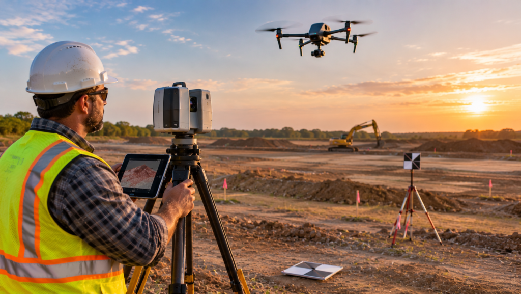
A drone can map a 50-acre site in an afternoon. A laser scanner can capture every pipe in a plant room in an hour. Both promise faster, richer data than a traditional survey crew with a tape and a total station, and both are now routine on construction, solar, and renovation projects. But the quality of what you get depends entirely on who does the work, how they control accuracy, and whether you asked for the right thing in the first place.
This guide explains drone surveying and 3D laser scanning in plain language: the methods, the difference between LiDAR and photogrammetry, the accuracy standards worth knowing, the rules for commercial drone operators in the US and UK, current cost benchmarks, and a checklist for choosing a provider. You will also see providers listed on Engineers Mirror that offer drone mapping or scanning.
Drone Surveying and Laser Scanning: What Are the Options?
These terms get mixed up, so here is a quick map of the main methods.
| Method | How it works | Best for |
|---|---|---|
| Drone photogrammetry | Overlapping photos from a drone are processed into maps and 3D models | Open sites, orthomosaics, volumes, progress tracking |
| Drone LiDAR | A laser sensor on a drone measures distances to build a point cloud | Sites with vegetation, corridors, terrain under tree cover |
| Terrestrial laser scanning (TLS) | A tripod-mounted scanner captures millions of points from fixed positions | Buildings, plants, bridges, high-detail as-builts |
| Mobile and handheld scanning | A scanner moves through a space while mapping it | Fast capture of interiors and complex layouts |
| Total station and GNSS | Traditional ground measurements by a surveyor | Boundaries, control points, stakeout, legal surveys |
Most serious projects combine methods. A drone surveys the surface, a ground crew sets control points and checks the results, and a laser scanner captures the buildings.
A Drone Map Is Not a Boundary Survey
This is the most important point for property owners. Drone data is excellent for terrain, volumes, and site conditions, but a legal boundary survey must be performed and signed by a licensed land surveyor. If you need to know where your property line is, see our guides to land survey cost, land surveyors in Kansas, and land surveyors in Maryland.
LiDAR vs Photogrammetry
The two main drone mapping methods suit different sites.
| Photogrammetry | LiDAR | |
|---|---|---|
| Captures | Images turned into 3D data | Laser measurements |
| Vegetation | Sees the surface it can photograph | Can record ground beneath tree cover |
| Outputs | Orthomosaics, surface models, 3D meshes | Classified point clouds, terrain models |
| Cost | Generally lower | Generally higher |
| Best for | Open, bare, or lightly vegetated sites | Wooded, uneven, or corridor sites |
Neither is automatically more accurate. Both can reach survey-grade results when the workflow is done properly, with ground control and checks. For a site with heavy vegetation, LiDAR is often the only way to see the ground. For an open construction site, photogrammetry may be all you need and will usually cost less.
What You Should Receive: Common Deliverables
Be specific about outputs before you order. Typical deliverables include:
- Orthomosaic. A geometrically corrected aerial image you can measure from.
- Digital surface and terrain models. Elevation data with or without objects such as buildings and trees.
- Contours. Elevation lines for design and drainage work.
- Point cloud. A dense 3D dataset, commonly delivered in formats such as LAS, LAZ, or E57.
- Volumes. Stockpile and earthwork quantities.
- CAD and GIS files. Drawings and layers in formats such as DWG, DGN, KMZ, and SHP.
- 3D models or BIM. Scan-to-BIM models for renovation and facility work. Our guide on how to choose a BIM modeling company explains levels of detail and accuracy for these models.
Also ask for the coordinate system and datum, and the format of any report that documents accuracy.
Accuracy: What to Ask For and How It Is Checked
Accuracy is where cheap work often falls short. Do not accept vague claims such as “survey-grade.” Ask the provider to state the accuracy they will achieve and how they will verify it. Three reference points help.
ASPRS Positional Accuracy Standards
For mapping data, the American Society for Photogrammetry and Remote Sensing publishes the Positional Accuracy Standards for Digital Geospatial Data. Edition 2, Version 2 was adopted in June 2024, is sensor-agnostic and data-driven, and includes addenda for lidar, photogrammetry, and mapping with unmanned aerial systems. A provider who understands it will talk about ground control, checkpoints, and reported error values rather than just resolution.
USIBD Level of Accuracy for Building Documentation
For scans of existing buildings, the U.S. Institute of Building Documentation publishes the Level of Accuracy (LOA) Specification, which defines five levels from LOA10 to LOA50 and describes the outcome that must be achieved, not how to capture the data. As LiDAR Magazine explains, the framework ties accuracy to intended use and distinguishes measured accuracy, how closely the data reflects reality, from represented accuracy, how closely a model reflects that data. A model cannot be more accurate than the scan it is based on.
UK Measured Survey Standards
In the UK, RICS publishes a professional standard on measured surveys of land, buildings and utilities, which sets out what clients should specify and what surveyors should provide.
How Accuracy Is Controlled
Ask how the provider will control and verify the result:
- Ground control points. Surveyed targets that tie the map to real-world coordinates.
- RTK or PPK positioning. Drone corrections that can reduce the number of ground control points needed.
- Independent checkpoints. Measured points that are not used in processing, used to test the result.
- Overlap and comparison. For scanning, comparing overlapping or independent scan datasets to catch drift.
- Written accuracy report. A summary of the method and test results.
Rules for Commercial Drone Operators
Before you hire anyone, confirm they are flying legally. A provider who ignores the rules exposes you to risk.
United States: FAA Part 107
In the US, commercial drone operations under 55 pounds fall under 14 CFR Part 107. The remote pilot must hold an FAA Remote Pilot Certificate with a small UAS rating, or be directly supervised by someone who does. You can read the requirements on the FAA commercial operators page. Operators also need to register their drones and comply with Remote ID, and certificate holders must complete recurrent training every 24 calendar months. Ask for the pilot’s certificate and the company’s insurance.
United Kingdom: CAA Rules
In the UK, drone operations fall into the Open, Specific, and Certified categories. Many low-risk commercial flights can be done in the Open category if they stay within its limits, while higher-risk work, such as flying closer to people, in congested areas, or beyond visual line of sight, needs a CAA Operational Authorisation in the Specific category. Since 1 January 2026, a Flyer ID is required for drones weighing 100 grams or more, and an Operator ID is required for drones with a camera. The CAA’s remote pilot qualification guidance explains the Flyer ID, the A2 Certificate of Competency, and the qualifications used for Specific category work. Remote ID requirements are also being phased in. Ask whether your project fits the Open category or needs an Operational Authorisation.
Canada and Elsewhere
If your project is in Canada, check Transport Canada’s requirements. We have not covered them here, and rules differ by country.
Insurance and Airspace
Whatever the country, ask for evidence of liability insurance, and ask who is responsible for checking airspace restrictions, permissions, and site access before flight.
8 Steps to Choose a Drone Surveying or Laser Scanning Provider
Step 1: Define the Purpose and the Accuracy You Need
State what the data is for, such as earthwork volumes, design, progress tracking, or an as-built model. Then state the accuracy and detail that purpose needs. A progress photo map and a design-grade topographic survey are different products.
Step 2: Choose the Right Method
Match the method to the site: photogrammetry for open ground, LiDAR for vegetation, terrestrial scanning for buildings and plants. A good provider will recommend a method and explain why, and will admit when a ground survey is the better tool.
Step 3: Check Legal Compliance
Ask for the pilot’s FAA certificate or CAA qualifications, registration and identification details, and proof of insurance. Ask whether the operation fits the standard rules or needs an authorization.
Step 4: Check Survey Credentials
For design-grade deliverables or anything that must be signed, confirm a licensed or chartered surveyor is responsible for the work. In the US, that means a state-licensed land surveyor. In the UK, look for chartered status and ask how the work follows measured survey standards.
Step 5: Review How Accuracy Is Controlled
Ask about ground control, RTK or PPK, checkpoints, and the written accuracy report. Ask who checks the data and what happens if it fails the test.
Step 6: Confirm Deliverables, Formats, and Coordinates
Agree the outputs, file formats, coordinate system, datum, and level of detail. If your engineer or architect needs CAD or BIM-ready data, show them the specification first.
Step 7: Look at Samples, References, and Turnaround
Ask for a sample deliverable on a similar project, and speak to a recent client. Ask about weather risk, flight and scan time, processing time, and how fast they can respond to questions.
Step 8: Agree Data Ownership and Contract Terms
Point clouds are large. Agree who owns the data, how long the provider stores it, how it is delivered, and what is included in the price. Make sure the contract covers revisions, re-flights, and liability.
What Does Drone Surveying and Laser Scanning Cost?
Published prices vary widely and depend on the site, the method, the accuracy, and the deliverables. The figures below are indicative and come from recent provider and industry guides.
| Service | Indicative price | Source type |
|---|---|---|
| Small site drone mapping survey (UK) | £700–£2,500 | UK drone software firm guide, 2026 |
| Topographical drone survey (UK) | £1,500–£6,000+ | UK drone software firm guide, 2026 |
| Basic drone orthomosaic (US) | About $10–$30 per acre | US drone software firm, 2026 |
| Engineering topographic deliverable with ground control (US) | About $50–$150 per acre | US drone software firm, 2026 |
| Indoor laser scanning (US) | About $0.20–$0.70 per sq ft, often with a $1,000 minimum | Scanning provider guide |
The UK figures come from Dronedesk’s drone survey price guide, and the US per-acre figures from SkyeBrowse’s 2026 drone survey cost guide, which also notes that per-acre pricing falls as the site grows and that small sites usually carry a project minimum. The indoor scanning figure comes from the guides we cite in our BIM modeling guide, and modeling is billed on top. These sources are vendors, and published LiDAR prices in particular vary widely from one guide to the next, so always request written quotes.
What Drives the Price
- Method. LiDAR sensors and processing usually cost more than photogrammetry.
- Site size. Larger sites cost less per acre because setup is mostly fixed.
- Accuracy. Survey-grade work needs ground control, checkpoints, and surveyor review.
- Terrain and vegetation. Difficult sites take longer to capture and process.
- Deliverables. Contours, CAD, and models cost more than a simple orthomosaic.
- Airspace and permissions. Restricted airspace or complex operations add effort.
- Revisits. Repeat flights for progress tracking can be priced as a package.
- Turnaround. Rush processing usually costs more.
To compare providers fairly, send each one the same brief. Our free engineering RFQ template gives you a ready-made request, response form, and scoring sheet.
Common Uses
- Construction progress and earthwork. Regular drone flights track progress and calculate volumes.
- Site design. Topographic data for grading, drainage, and layout. Our guide on how to choose a civil engineering firm explains how survey data feeds site design.
- Solar and infrastructure sites. Large areas and corridors are efficient to map by drone. See our solar engineering cost guide for design context.
- As-built and renovation documentation. Terrestrial scanning captures existing conditions for models and drawings.
- Industrial and plant work. Scanning records piping, equipment, and clearances. Our guide on how to choose an industrial automation company covers the controls side of such projects.
Red Flags to Avoid
- A quote that does not state the accuracy, deliverables, or method
- No pilot certificate, registration, or insurance evidence
- Claims of “survey-grade” accuracy with no ground control or checkpoints
- No written accuracy report
- Offering to replace a boundary survey with a drone map
- No licensed or chartered surveyor involved in design-grade work
- A price far below every other quote, with no explanation
- No sample deliverable or references
- Vague answers about data ownership and storage
12 Questions to Ask Before You Hire
- What will the data be used for, and what accuracy do you recommend?
- Which method do you propose, and why?
- Who is the licensed or certificated pilot, and can I see the certificate?
- Do you carry liability insurance, and at what level?
- Is a licensed or chartered surveyor responsible for the work?
- How do you control and verify accuracy, and will I get a written report?
- Do you use ground control points, RTK or PPK, and independent checkpoints?
- What deliverables and file formats will I receive?
- Which coordinate system and datum will you use?
- What is the turnaround time, and what weather risks apply?
- Who owns the data, and how long do you store it?
- Can I see a sample and speak to a recent client?
Find Drone Surveying and Laser Scanning Providers on Engineers Mirror
Engineers Mirror is an independent directory that helps you compare engineering and surveying firms by category, location, and specialty. The directory does not have a separate drone or scanning category, but several listed companies mention these services in their profiles.
- Rock Run Surveying, LLC (Rising Sun, Maryland). Lists 3D terrestrial scanning and aerial drone mapping alongside boundary and topographic surveying, serving Cecil, Harford, Carroll, and Frederick Counties.
- RUF Land Surveyors (Chevy Chase, Maryland). Lists 3D scanning and deformation monitoring among a wide range of survey services, with deliverables in formats including PDF, DWG, DGN, KMZ, and SHP.
- Atlas Land Consulting, LLC (Basehor, Kansas). A civil engineering, land surveying, inspection, and drone services firm.
- BHC Civil Engineering & Surveying (Overland Park, Kansas). Lists 3D laser scanning among its survey services.
- Tejjy Inc. (Rockville, Maryland). Lists BIM and 3D LiDAR scanning.
- Kelar Pacific (San Diego, California). Lists BIM, digital construction, and 3D laser scanning.
- The Drafting Company (Los Angeles, California). Lists BIM modeling, CAD drafting, 3D solid modeling, and laser scanning.
You can browse the Surveying category, the BIM Modeling category, and the Site Planning category, or see all engineering companies in the United States and the United Kingdom. A listing is not an endorsement, so always verify credentials, insurance, and accuracy methods before you hire.
Prefer to send one brief and let providers come to you? Use the project form on the Engineers Mirror homepage. Pick Surveying as the service, choose a budget range and timeline, and describe your site and the data you need. It is free for buyers, and providers reply to you directly.
If you run a drone surveying or scanning company, you can list your company for free, claim your listing to add your services and credentials, or look at the Featured plans to appear at the top of your category page.
Final Thoughts on Drone Surveying and 3D Laser Scanning
The best provider for drone surveying or laser scanning is the one that starts with your purpose, recommends the right method, explains how accuracy will be controlled and tested, flies legally and safely, and delivers files you can actually use. A fast flight and a pretty point cloud are not enough.
Define the accuracy you need, choose the method, verify the credentials and insurance, compare written quotes on more than price, and agree the deliverables and data ownership up front. Do that and drone and scan data will save you time and money instead of creating rework.
Ready to compare? Browse the Surveying and BIM Modeling categories on Engineers Mirror, or send one project brief and let the right providers come to you.
Frequently Asked Questions
What is drone surveying?
Drone surveying uses unmanned aircraft carrying cameras or laser sensors to capture data about land and structures, which is processed into maps, elevation models, point clouds, and volumes. It is fast for large sites, but it does not replace a licensed boundary survey.
How accurate is drone surveying?
It depends on the method, the equipment, the ground control, and the processing. With proper ground control, RTK or PPK corrections, and independent checkpoints, drone mapping can reach survey-grade results. Ask the provider to state the accuracy they will achieve and how they will verify it.
What is the difference between LiDAR and photogrammetry?
Photogrammetry builds 3D data from overlapping photos and works well on open sites. LiDAR uses laser measurements, can record ground beneath vegetation, and usually costs more. Both can be accurate when done properly.
Do drone surveyors need a license?
Drone pilots flying commercially in the US need an FAA Remote Pilot Certificate under Part 107, and UK operators need the Flyer ID and Operator ID required by the CAA, with an Operational Authorisation for higher-risk work. Separately, survey-grade deliverables should be overseen by a licensed or chartered surveyor.
How much does a drone survey cost?
Published guides give very different ranges. One UK guide puts small site mapping at £700 to £2,500 and topographical drone surveys at £1,500 to £6,000 or more, and one US guide puts basic orthomosaics at about $10 to $30 per acre and engineering topographic deliverables with ground control at about $50 to $150 per acre. Always get written quotes.
What is scan-to-BIM?
Scan-to-BIM is the process of capturing an existing building with a laser scanner and converting the point cloud into an intelligent 3D model. It is used for renovations and as-built documentation. The model cannot be more accurate than the scan it is based on.
Looking for engineering companies?
Compare 825 verified engineering companies on Engineers Mirror and contact them directly.