
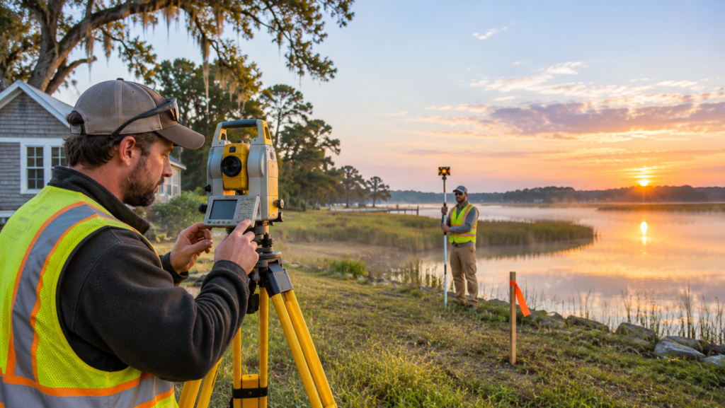
Maryland packs a lot of land use into a small state: Chesapeake Bay shoreline and farmland on the Eastern Shore, fast-growing suburbs around Washington and Baltimore, and rural counties in between. That mix means land surveys come up constantly, from a lender asking for a location drawing at closing to a developer needing an ALTA survey for a commercial sale.
This guide profiles land surveyors in Maryland that are listed on Engineers Mirror, from the Eastern Shore to the Washington suburbs. You will see what each says it does, how Maryland’s survey rules work, the difference between a location drawing and a boundary survey, and how to choose and compare surveyors before you hire.
How We Selected These Land Surveyors in Maryland
The firms below are listed on Engineers Mirror with a Maryland address and land surveying as a core service. Details come from each company’s directory profile. Companies are presented in no particular order. This is not a ranking, and a listing is not an endorsement. Verify licenses, insurance, and references with each firm before you hire.
Land Surveyors in Maryland at a Glance
| Firm | Based in | Area served | What its profile says |
|---|---|---|---|
| Andrews Land Surveying | Preston | Eastern Shore, most of the Western Shore, and parts of Delaware | Boundary, location drawings, topographic, ALTA, stakeout, legal descriptions |
| Rock Run Surveying, LLC | Rising Sun | Cecil, Harford, Carroll, and Frederick counties | Boundary, topographic, 3D scanning, and drone mapping |
| RUF Land Surveyors | Chevy Chase | Montgomery, Prince George’s, Frederick, and Howard counties | ALTA/NSPS, boundary, topographic, as-built, construction layout, 3D scanning |
Profiles of Land Surveyors in Maryland
Andrews Land Surveying (Preston)
Andrews Land Surveying is a professional land surveying company based in Preston that serves property owners, real estate professionals, developers, contractors, and engineering firms across Maryland and Delaware. According to its profile, it opened in February 2011 and expanded into Maryland in 2012, and its coverage includes the entire Eastern Shore of Maryland, most of the Western Shore, and Kent and Sussex Counties in Delaware.
Services include boundary surveys, location drawings, topographic surveys, ALTA surveys, construction stakeout, legal descriptions, and site plans. For property transactions, the company says its location drawings are commonly prepared for lenders and insurers, with typical turnaround of about two to four business days depending on workload. It also describes stakeout services for additions, site infrastructure, and fences, using robotic field technology and CAD software.
Best for: Eastern Shore property owners, buyers, and builders who need boundary work, closing documents, or stakeout.
Rock Run Surveying, LLC (Rising Sun)
Rock Run Surveying is a professional land surveying company in Rising Sun serving property owners, developers, contractors, and other clients across Cecil, Harford, Carroll, and Frederick Counties. Its profile lists boundary surveying and mapping, topographic surveying, 3D terrestrial scanning, and aerial drone mapping, and says its drone mapping is FAA certified and overseen by a professional surveyor.
Best for: northern and central Maryland projects that benefit from drone mapping or 3D scanning alongside a traditional boundary or topographic survey.
RUF Land Surveyors (Chevy Chase)
RUF Land Surveyors is a Maryland-licensed land surveying company based in Chevy Chase that serves Montgomery, Prince George’s, Frederick, and Howard Counties and surrounding areas. Its profile lists an unusually wide service menu: ALTA/NSPS surveys, boundary surveys, topographic surveys, as-built surveys, construction layout, utility surveys, architectural surveys, property line determination, house location plans, record plats, easement descriptions, zoning reports, FEMA elevation certificates, deformation monitoring, and 3D scanning.
The company says it delivers data in formats including PDF, DWG, DGN, KMZ, SHP, TXT, and XML, which can matter if your architect or engineer needs files for a specific workflow.
Best for: Washington-area developers, architects, contractors, and property owners who need detailed site data, commercial survey standards, or CAD-ready deliverables.
Related: Scanning and BIM Firms in Maryland
Some Maryland companies on the directory do reality capture and modeling rather than boundary surveying. Tejjy Inc. in Rockville lists 3D LiDAR scanning and BIM services, and BIM Technologies, Inc. lists BIM and MEP modeling in Maryland. They do not replace a licensed land surveyor for boundary work, but they can help when you need an as-built model of an existing building. Our guide on how to choose a BIM modeling company explains scan-to-BIM in detail.
Types of Surveys You May Need in Maryland
| Survey | What it does | Typical use |
|---|---|---|
| Boundary survey | Establishes the position and extent of property boundaries, with monuments set and a plat produced | Fences, disputes, sales, building |
| Location drawing | Shows visible improvements in relation to the property, for lenders and insurers | Home purchase closings |
| Topographic survey | Maps elevations, contours, and site features | Design, grading, drainage |
| ALTA/NSPS land title survey | Detailed standardized survey for title and lender requirements | Commercial transactions |
| Construction stakeout | Marks locations from design plans | Foundations, additions, fences |
| Easement and right-of-way survey | Locates a strip or parcel for use by others | Utilities, access |
| Metes and bounds description | A written legal description of a tract | Deeds and conveyances |
| As-built survey | Records what was actually built | Closeout, records |
| FEMA elevation certificate | Documents a structure’s elevation for flood insurance | Flood zone properties |
| Drone and 3D scanning | Captures large or complex sites digitally | Mapping, monitoring, modeling |
Location Drawing vs Boundary Survey
This is the most important distinction for anyone buying a home in Maryland. A location drawing is the document most buyers receive at settlement, but it is not a boundary survey. Under Maryland’s minimum standards (COMAR 09.13.06.06), a location drawing is meant to give lenders or insurers some assurance that improvements are on the property, and it carries a statement that it cannot be relied on to show where the boundaries are. If you plan to build a fence, add on to your house, or settle a line dispute, order a boundary survey instead.
For price benchmarks on common survey types, see our guide to land survey cost. If your property is in a flood zone, you can check an address on the FEMA Flood Map Service Center.
Maryland Rules for Land Surveyors
Licensing
Land surveying in Maryland is regulated by the Maryland Board for Professional Land Surveyors, which licenses individuals and issues permits to business entities through which land surveying is practiced, according to the state’s license information. Maryland recognizes two kinds of practitioner: a professional land surveyor and a licensed property line surveyor. Always confirm which license the person who signs your survey holds, and that the firm holds its business permit.
Minimum Standards
Maryland’s Minimum Standards of Practice, COMAR 09.13.06, set the baseline for everyone practicing professional land surveying and property line surveying in the state. They cover boundary surveys, topographic and planimetric surveys, location drawings, metes and bounds descriptions, and right-of-way and easement surveys. A boundary survey under the standards involves monuments and a plat showing items such as a title, location, scale, date, and land area. When a licensee signs and seals surveying documents, the standards require the license expiration date to be shown.
Waterfront Properties
Maryland’s long tidal shoreline can add complexity to boundaries on waterfront lots. If your property touches the Bay or a tidal river, ask a surveyor about experience with waterfront boundaries and any shoreline or buffer rules that apply to your project.
How to Choose Among Land Surveyors in Maryland
- Define the survey you need. Tell the surveyor the purpose, such as a closing, a fence, an addition, a dispute, or a commercial sale.
- Verify the Maryland license. Confirm the individual who will sign and seal is a licensed professional land surveyor or property line surveyor, and ask whether the firm holds a business permit.
- Ask about the standards. The surveyor should work to COMAR 09.13.06.
- Match experience to your survey. Ask about similar ALTA, boundary, waterfront, or construction surveys.
- Know the county. A surveyor who works regularly in your county knows the records and local requirements.
- Confirm the deliverables. Ask whether you will receive a signed and sealed plat, a legal description, or CAD and GIS files, and in what formats.
- Check insurance. Ask for evidence of professional liability coverage.
- Compare written quotes. Look at scope, deliverables, timeline, and exclusions. Our free engineering RFQ template helps you send the same brief to several firms.
- Talk to references. Speak to a recent client with a similar project.
If your project also needs site design, see our guide to how to choose a civil engineering firm, and our explainer on structural engineer vs civil engineer vs land surveyor shows how the roles fit together. For a comparison with another state’s rules, read our guide to land surveyors in Kansas.
10 Questions to Ask Before You Hire
- Are you a Maryland licensed professional land surveyor or property line surveyor, and who will sign the work?
- Which type of survey do you recommend for my purpose?
- Will you work to Maryland’s minimum standards of practice?
- What exactly will I receive, and in what format?
- What is the total price, and what is excluded?
- Will you set monuments, and is that included?
- Do you handle waterfront or tidal boundaries?
- How long will fieldwork and delivery take?
- Do you carry professional liability insurance?
- Can I see a sample and speak to a recent client?
What Affects Survey Fees in Maryland?
Published prices vary widely, and we do not quote Maryland figures here. The main factors are the type of survey, the size and shape of the parcel, terrain and vegetation, the quality of existing records, the number of corners to find or set, the deliverables you need, and the timeline. A simple location drawing for a closing costs less effort than a boundary survey or an ALTA survey. For general benchmarks, see our land survey cost guide.
Common Maryland Survey Situations
- Buying a home. Expect a location drawing for the lender, and consider a boundary survey if you plan fences, additions, or have any doubt about the lines.
- Fence or boundary dispute. Order a boundary survey, with monuments set and a plat produced.
- Building an addition or new home. You will typically need a topographic survey for design and stakeout during construction.
- Waterfront property. Ask about tidal boundaries and any shoreline rules before you design.
- Commercial sale or financing. Lenders and title companies often require an ALTA/NSPS survey.
- Subdividing land. You will need a licensed surveyor to prepare the plat and legal descriptions.
Find More Land Surveyors in Maryland
Engineers Mirror is an independent directory that helps you compare engineering and surveying firms by category, location, and specialty. Browse the Surveying category or look at companies in Preston, Rising Sun, and Chevy Chase. You can also see all engineering companies in the United States.
A listing is not an endorsement, so always verify licenses, insurance, and references before you hire.
Prefer to send one brief and let surveyors come to you? Use the project form on the Engineers Mirror homepage. Pick Surveying as the service, choose a budget range and timeline, and describe your property. It is free for buyers, and providers reply to you directly.
If you run a surveying firm in Maryland, you can list your company for free, claim your listing to update your services and credentials, or look at the Featured plans to appear at the top of your category page.
Final Thoughts on Land Surveyors in Maryland
The best of the land surveyors in Maryland for your project is the one with the right Maryland license, experience with your type of survey and your county, and a clear written scope. A location drawing for a closing, a boundary survey for a fence line, and an ALTA survey for a commercial deal are different jobs with different standards and different prices.
Define your purpose, shortlist two or three surveyors, verify licenses and references, and compare written quotes on more than price. Do that and you will get a survey that does the job you actually need it to do.
Ready to compare? Browse the profiles above, or send one project brief on Engineers Mirror and let the right surveyors come to you.
Frequently Asked Questions
Do I need a licensed surveyor in Maryland?
Yes, for any survey you want to rely on. Land surveying in Maryland is regulated by the Maryland Board for Professional Land Surveyors, and surveys must follow the state’s minimum standards of practice. Confirm that the person who signs and seals your survey holds a current Maryland license.
What is the difference between a location drawing and a boundary survey in Maryland?
A location drawing shows visible improvements in relation to the property and is prepared for a lender or insurer. It cannot be relied on to show where the boundaries are. A boundary survey establishes the physical position and extent of the property boundaries, sets monuments, and produces a plat.
How do I verify a Maryland land surveyor?
Ask for the surveyor’s Maryland license type and number, and check it with the Maryland Board for Professional Land Surveyors. Also ask whether the firm holds a business entity permit and whether the licensee shows an expiration date on sealed documents, as the standards require.
How long does a land survey take in Maryland?
It depends on the type of survey, the property, weather, and the surveyor’s workload. One Maryland surveyor’s profile says location drawings typically take about two to four business days, while boundary, topographic, and ALTA surveys usually take longer. Ask each surveyor for a realistic schedule.
What does an ALTA survey cost in Maryland?
Prices vary widely by property, location, and survey requirements, and we do not quote a Maryland figure. ALTA/NSPS surveys involve more research and detail than a basic boundary survey, so they usually cost more. Request written quotes for the same scope from two or three firms.
How do I get comparable quotes from several surveyors?
Send the same written brief to each one, covering the purpose, property location, deliverables, and timeline. Our RFQ template gives you a ready-made structure and a scoring sheet.
Looking for engineering companies?
Compare 825 verified engineering companies on Engineers Mirror and contact them directly.